River Lot Plaques
Crow Wing River Lots
Waypoint Info
Lat Long
(49.569310, -97.105440)
GPS Coordinates
49° 34′ 9.516” N
97° 6′ 19.584” W
Next Waypoint (East)
Niverville
Previous Waypoint (West)
Mennonite Landing
History of the site
This spot demonstrates two different approaches to land settlement… and it also demonstrates two different cultures.
Following the map, you’ll notice that the road in this location forms “steps”. It no longer goes straight for miles at a time, but zigs and zags its way north from Provincial Road 305.
To the west are long skinny river lots, reaching the Red River. To the east are the squares of the township/range grid. This is where the two meet.
You see, in 1869, the Hudson’s Bay Company gave the Canadian government 300,000 pounds for Rupert’s Land, and immediately sent out surveyors to set up new townships and ready the land for settlers.
However, the Red River Settlement had been established in 1812 – and they surveyed their land differently. At the time, the river was their highway, so land was divided into long thin lots that gave everyone access to the river. These river lot strips ran from the river back for two miles (3.2 km) and sometimes an additional two miles for hay land.
Here these two systems of surveying the land meet on the Manitoba prairies.
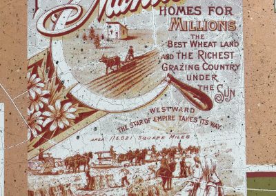
The square blocks of the township/range grid survey system were later instituted by the Dominion Government as an easy way to establish farms across the Prairies.
When they arrived in 1874, Mennonites were some of the first settlers to lay claim to these newly surveyed blocks of land.
Transformation
This section of the Peace Trail overlaps with the Crow Wing Trail – the development of which had first begun in 2001. The plaques you see here were erected by the Crow Wing Trail committee, possibly in the early 2000s.
What you see here today
Dirt roads and farmland for as far as the eye can see!
The three plaques are set by a tree. In the distance, likely behind you as you emerge from the Mennonite Landing, you’ll see the trees along the banks of the Red River. But ahead of you? More farmland.
A note on the dirt roads: be particularly careful. They are excellent to drive on when they are very dry, but with moisture they become entirely impassable.


