Niverville
Niverville
Waypoint Info
Lat Long
(49.596084, -97.040600)
GPS Coordinates
449° 35′ 45.9024” N
97° 2′ 26.16” W
Next Waypoint (East)
Shantz Immigration Sheds Cairn
Previous Waypoint (West)
Crow Wing Trail River Lot Plaques
History of the site
Before Europeans arrived to disrupt the rhythm of Indigenous people’s lives here, this region teemed with diverse wildlife and saw the seasonal life of the Indigenous peoples home to this land before any fur traders or settlers came to occupy these lands.
Niverville was part of a key transportation route, the Crow Wing Trail, which Métis used with their innovative Red River Carts. Métis were instrumental in facilitating the settlement of the Mennonites who arrived from 1874-76, transporting baggage and the infirm from the river to the immigration sheds.
The principal figure in the early development of Niverville was William Hespeler, immigration agent for the Government of Canada and liaison for the Mennonites arriving in Manitoba. He purchased part of NW 30, broke it into lots, developed a town plan, and it grew from there. For a short time, the town was known as Hespeler, though when the railway station arrived, its name, Niverville, was ultimately the name that stuck.
Transformation
In 2021, Niverville lost its last elevator. That same year, the Heritage Wall was envisioned, designed, and built locally.
A replica Red River Cart was built by Master Red River Cart Builder Armand Jerome, for display in Niverville to remind everyone of the vital role the Métis nation played the development of the region.
What you see today
There are several spots denoting Niverville’s history and heritage, so a tour around the town may be in order.
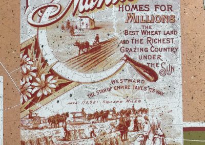
The 64-foot metal Heritage Wall is found on Niverville’s Main Street, separating the parking lot of the Niverville Credit Union from the sidewalk. The wall depicts the history of the area, beginning with bison and Indigenous people, to a Red River Cart, to Mennonites getting off the boat, to the CPR train station, to the town’s iconic round elevator.
The Red River Cart rests outside the Niverville Centennial Arena.
The Peace Trail also passes through Hespeler Park, and links with the Crow Wing Trail here.
Niverville is a great place to stock up on snacks and water as you prepare for the rest of your journey along the Peace Trail.


