Gruenfeld
Gruenfeld Cemetery
Waypoint Info
Lat Long
(49.528192, -96.876722)
GPS Coordinates
49° 31′ 41.4912” N
96° 52′ 36.1992” W
Next Waypoint (East)
Chortitz
Previous Waypoint (West)
Tourond Creek Discovery Centre
History of the site
Gruenfeld was the site of the first Mennonite street village in Manitoba. Situated on the east half of section 32-6-5E, the main street of the village followed the natural elevation of the land and was angled from the southeast to the northwest. Upon their arrival, the first Mennonite settlers hired a local Métis man to survey the village plan. Each of the seventeen lots measured about 13 rods in width and 100 rods deep, all lots being perpendicular to the main street, including a middle street with a width of 8 rods.
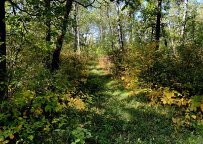
An aerial photo of 1946 still shows the orientation of the village, the main street, the middle street, and the back street. Since that date the main street is under cultivation and only part of the middle and back street still exist as trails in the bush.
Two churches, the Kleine Gemeinde and the Holdeman church, are found on section 32. The Kleine Gemeinde, now known as the Evangelical Mennonite church, is on road 35N. The Holdeman or The Church of God in Christ, Mennonite is on Highway 216. Both churches conducted services in private homes in early village history and buried their deceased in the pioneer cemetery.
Transformation
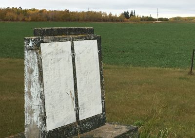
In 1970, a cairn was erected on the site of the Gruenfeld pioneer cemetery to commemorate the early settlers. It should be noted that not all the names listed on the cairn are buried here.
What you see today
The cemetery cairn is in the middle of a field and can legally be accessed by the public from Highway 216.
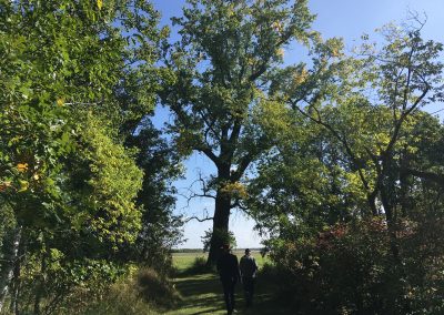
Likely the only visible reminder of 1874 Gruenfeld is the tall cottonwood tree seen from the 216 which overlooked this pioneer village.
The north portion of the back street trail can be accessed by turning off Highway 52 at Honey Lane and proceeding south to Peter’s Honey Farm. Park your vehicle here and prepare to walk or bike half a mile. The trail terminates at the cemetery of the EMC church. This trail is on private land but the owners, Lorne and Ingrid Peters, have graciously opened this historic trail to the public for 2022.


